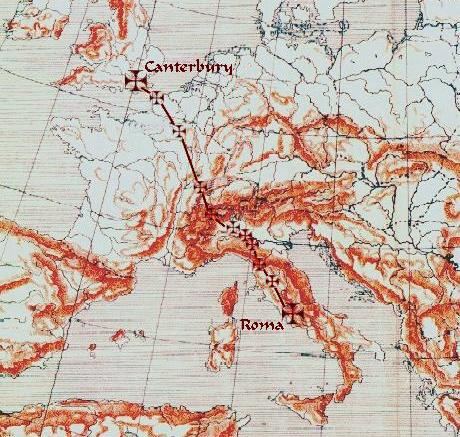
A Via Francigena map
The Via Francigena in Canterbury
The Via Francigena starts beside the south porch of Canterbury Cathedral at
the kilometre zero stone. Pilgrim passports are stamped at the Information
Centre in the Cathedral Precincts.
Leave the Cathedral via the Christchurch Gate and turn left onto Burgate and
continue along Church Street and Longport, beside St. Augustine's Abbey.
After passing North Holmes Road and St Martin's Church, turn right onto
Pilgrim's Way and begin to follow the signs for the North Downs Way.
The pathway to Dover is nearly 20 miles long and will take between seven and
eight hours on foot.
The pathway offers opportunities to return to Canterbury by train using the
stations at Bekesbourne, Adisham, Aylesham, Shepherdswell and Dover
Priory.
The Via Francigena and the pilgrimage to Rome
The past
The Via Francigena was the major medieval pilgrimage route to Rome from the north; even today pilgrims travel this route, but in far fewer numbers than the Way of St. James (Camino de Santiago). The route was first documented as the "Lombard Way", and was first called the "Frankish Route", the Iter Francorum, in the Itinerarium sancti Willibaldi of 725, recording the travels of Willibald,bishop of Eichstätt in Bavaria. The Via Francigena is first mentioned in the Actum Clusio, a parchment of 876 in the Abbey of San Salvatore al Monte Amiata (Tuscany). At the end of the 10th century Sigeric the Serious, the Archbishop of Canterbury, used the Via Francigena to and from Rome to be consecratedby the Pope; he recorded his route and his stops on the return journey, but nothing in the document suggests that the route was then new. Other itineraries include those of the Icelandic traveller Nikolás Bergsson (in 1154) and Philip Augustus of France (in 1191).Two somewhat differing maps of the route appear in manuscripts of Matthew Paris, Historia Anglorum, from the 13th century.
In 1985 the Italian archaeologist of roads, Giovanni Caselli, retraced the itinerary as described by Archbishop Sigeric. The Welshman Rhodri Mawr in AD 880 and his grandson Howell the Good in 945 are both known to have visited Rome towards the end of their lives, but it is not known whether they went by land or by the dangerous and pirate-infested sea route via Gibraltar. Reports of journeys before Sigeric can only be apocryphal. We may be quite certain that the Benedictine St Thierry, known as William of St Thierry, used the roads towards Rome on several occasions at the end of the 11th century. The return journey by
sea was likely to be easier, thanks to the prevailing south-westerly winds, but tacking down to the Mediterranean would have made a very long journey indeed. A statement that a historical figure "died in Rome" may have been a historical falsity, but a metaphorical truth.
The Via Francigena was not a single road, like a Roman road, paved with stone blocks and
provided at intervals with a change of horses for official travellers. Rather, it comprised several possible routes that changed over the centuries as trade and pilgrimage developed and waned. Depending on the time of year, political situation, and relative popularity of the shrines of saints along the route, travellers may have used any of three or four crossings of the Alpsand the Apennines. The Lombards financed the maintenance and defence of the section of road through their territories as a trading route to the north from Rome, avoiding enemy-held cities such as Florence. Unlike Roman roads, the Via Francigena did not connect cities, but relied more on abbeys.
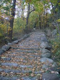
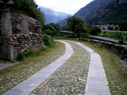
A steep section of the Via Francigena in Settimo Vittone, Piedmont.
The present
Today some pilgrims still follow in Sigeric's ancient footsteps to Rome on foot, on horseback or by bicycle. However, they are far fewer than on the Way of St. James pilgrims' route to Santiago de Compostela in Spain. Consequently there is far less in the way of accommodation and other facilities for pilgrims along the route. Pilgrimsin Italy often camp out rather than staying in hotels (which would prove very expensive over the weeks of the journey) though stays in pensionsare a mid-priced option.
Walkers could choose to walk along the EuroveloEV5 cycling route (named the 'Via
Francigena') when this is finished. However, it varies substantially from the route given by the VF Association.
Recent developments
In 1994 the Via Francigena was designated a European Cultural Route by the Council of
Europe. In November 2005, Italian politician Romano Prodi announced that he would revitalize the Via Francigena if elected Prime Minister in the 2006 election.
On 11 August 2007 a group of 27 cyclists, including several members of Canterbury City Council, set out from Canterbury Cathedral to ride the Via Francigena to Rome in 16 days.
This was a charity ride to raise money for the restoration of the cathedral and for other causes.
In November 2009 the Italian government launched a project to recover the Italian leg of it. The object of the plan is to recover the entire route (disjointed parts of which are already signposted) “not only in spiritual and religious terms but also in terms of the environment,
architecture, culture, history, wine and cuisine and sport.” The initiative was promoted by the Region of Tuscany, which hosts 400km of the Via, and which presented a plan detailing the low environmental impact infrastructures to be created. The plan will be shared with other local authorities located along the route as an encouragement to carry out similar recovery work. Tuscany has also announced cooperation with the Opera Romana Pellegrinaggi (ORP), the Vatican’s organisation for encouriging pilgrimages
Itinerary
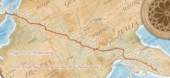
The 80 stages in Sigeric's itinerary averaged about 20 km a day, covering some 1700 km; they have helped to identify the route.
Having crossed the English Channel to Calais, or, following Sigeric's example to Wissant, still called Sumeran (Sombres) by Sigeric, a pilgrim bound for Rome might stay in Gisne (Guines), Teranburh Thérouanne, Bruaei (Bruay), Atherats (Arras), Reims, Châlons-sur-Marne, Bar-sur-Aube, Langres, Besançon, Pontarlier, Lausanne and Saint-Maurice, then travel over the Great St. Bernard Pass to Aosta, Ivrea, Vercelli, Pavia, Fidenza, Aulla, Luni, Lucca, San Gimignano, Poggibonsi, Siena, San Quirico, Bolsena, Viterbo and Sutri before reaching Rome.
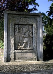
One of the best-known places on the Via Francigena is the Passum Padi in the municipality of Senna Lodigiana, where Sigeric crossed the Po River. Today a monument marks the spot.
Leggenda della Chiesa Santa Maria in Galilea nel comune di Senna Lodigiana
Una leggenda racconta che le bassure intorno a Senna, l’antica Curtis Sinna dei Carolingi, erano occupate da un immenso specchio d’acqua, il lago Gerundo.
Una principessa in viaggio in barca lungo il lago, fu sorpresa da un fortissimo vento che ben presto si tramutò in tempesta. I due servi che l’accompagnavano, impauriti, nell’impossibilità di governare la barca, lasciarono andare i remi. La principessa, vistasi in grave pericolo di vita, raccomandò la sua anima alla Madonna. L’imbarcazione, sballottata da onde mai viste, ben presto fu sommersa dalle acque tumultuose, ma la principessa riuscì ad aggrapparsi ad un tronco dell’albero galleggiante ed a salvarsi. Per ringraziare la Vergine dell’aiuto ricevuto, la bella principessa fece innalzare un tempio proprio nel punto più alto sovrastante il lago, a perenne ricordo della grazia ricevuta. Il tempio è l’attuale chiesa di S. Maria in Galilea. Nel secolo XIV° la chiesa era sede di un monastero di monache cistercensi affiliato al monastero omonimo di Piacenza.
The Via Francigena was the major medieval pilgrimage route to Rome from the north; even today pilgrims travel this route, but in far fewer numbers than the Way of St. James (Camino de Santiago). The route was first documented as the "Lombard Way", and was first called the "Frankish Route", the Iter Francorum, in the Itinerarium sancti Willibaldi of 725, recording the travels of Willibald,bishop of Eichstätt in Bavaria. The Via Francigena is first mentioned in the Actum Clusio, a parchment of 876 in the Abbey of San Salvatore al Monte Amiata (Tuscany). At the end of the 10th century Sigeric the Serious, the Archbishop of Canterbury, used the Via Francigena to and from Rome to be consecratedby the Pope; he recorded his route and his stops on the return journey, but nothing in the document suggests that the route was then new. Other itineraries include those of the Icelandic traveller Nikolás Bergsson (in 1154) and Philip Augustus of France (in 1191).Two somewhat differing maps of the route appear in manuscripts of Matthew Paris, Historia Anglorum, from the 13th century.
In 1985 the Italian archaeologist of roads, Giovanni Caselli, retraced the itinerary as described by Archbishop Sigeric. The Welshman Rhodri Mawr in AD 880 and his grandson Howell the Good in 945 are both known to have visited Rome towards the end of their lives, but it is not known whether they went by land or by the dangerous and pirate-infested sea route via Gibraltar. Reports of journeys before Sigeric can only be apocryphal. We may be quite certain that the Benedictine St Thierry, known as William of St Thierry, used the roads towards Rome on several occasions at the end of the 11th century. The return journey by
sea was likely to be easier, thanks to the prevailing south-westerly winds, but tacking down to the Mediterranean would have made a very long journey indeed. A statement that a historical figure "died in Rome" may have been a historical falsity, but a metaphorical truth.
The Via Francigena was not a single road, like a Roman road, paved with stone blocks and
provided at intervals with a change of horses for official travellers. Rather, it comprised several possible routes that changed over the centuries as trade and pilgrimage developed and waned. Depending on the time of year, political situation, and relative popularity of the shrines of saints along the route, travellers may have used any of three or four crossings of the Alpsand the Apennines. The Lombards financed the maintenance and defence of the section of road through their territories as a trading route to the north from Rome, avoiding enemy-held cities such as Florence. Unlike Roman roads, the Via Francigena did not connect cities, but relied more on abbeys.
A steep section of the Via Francigena in Settimo Vittone, Piedmont.
The present
Today some pilgrims still follow in Sigeric's ancient footsteps to Rome on foot, on horseback or by bicycle. However, they are far fewer than on the Way of St. James pilgrims' route to Santiago de Compostela in Spain. Consequently there is far less in the way of accommodation and other facilities for pilgrims along the route. Pilgrimsin Italy often camp out rather than staying in hotels (which would prove very expensive over the weeks of the journey) though stays in pensionsare a mid-priced option.
Walkers could choose to walk along the EuroveloEV5 cycling route (named the 'Via
Francigena') when this is finished. However, it varies substantially from the route given by the VF Association.
Recent developments
In 1994 the Via Francigena was designated a European Cultural Route by the Council of
Europe. In November 2005, Italian politician Romano Prodi announced that he would revitalize the Via Francigena if elected Prime Minister in the 2006 election.
On 11 August 2007 a group of 27 cyclists, including several members of Canterbury City Council, set out from Canterbury Cathedral to ride the Via Francigena to Rome in 16 days.
This was a charity ride to raise money for the restoration of the cathedral and for other causes.
In November 2009 the Italian government launched a project to recover the Italian leg of it. The object of the plan is to recover the entire route (disjointed parts of which are already signposted) “not only in spiritual and religious terms but also in terms of the environment,
architecture, culture, history, wine and cuisine and sport.” The initiative was promoted by the Region of Tuscany, which hosts 400km of the Via, and which presented a plan detailing the low environmental impact infrastructures to be created. The plan will be shared with other local authorities located along the route as an encouragement to carry out similar recovery work. Tuscany has also announced cooperation with the Opera Romana Pellegrinaggi (ORP), the Vatican’s organisation for encouriging pilgrimages
Itinerary
The 80 stages in Sigeric's itinerary averaged about 20 km a day, covering some 1700 km; they have helped to identify the route.
Having crossed the English Channel to Calais, or, following Sigeric's example to Wissant, still called Sumeran (Sombres) by Sigeric, a pilgrim bound for Rome might stay in Gisne (Guines), Teranburh Thérouanne, Bruaei (Bruay), Atherats (Arras), Reims, Châlons-sur-Marne, Bar-sur-Aube, Langres, Besançon, Pontarlier, Lausanne and Saint-Maurice, then travel over the Great St. Bernard Pass to Aosta, Ivrea, Vercelli, Pavia, Fidenza, Aulla, Luni, Lucca, San Gimignano, Poggibonsi, Siena, San Quirico, Bolsena, Viterbo and Sutri before reaching Rome.
One of the best-known places on the Via Francigena is the Passum Padi in the municipality of Senna Lodigiana, where Sigeric crossed the Po River. Today a monument marks the spot.
Leggenda della Chiesa Santa Maria in Galilea nel comune di Senna Lodigiana
Una leggenda racconta che le bassure intorno a Senna, l’antica Curtis Sinna dei Carolingi, erano occupate da un immenso specchio d’acqua, il lago Gerundo.
Una principessa in viaggio in barca lungo il lago, fu sorpresa da un fortissimo vento che ben presto si tramutò in tempesta. I due servi che l’accompagnavano, impauriti, nell’impossibilità di governare la barca, lasciarono andare i remi. La principessa, vistasi in grave pericolo di vita, raccomandò la sua anima alla Madonna. L’imbarcazione, sballottata da onde mai viste, ben presto fu sommersa dalle acque tumultuose, ma la principessa riuscì ad aggrapparsi ad un tronco dell’albero galleggiante ed a salvarsi. Per ringraziare la Vergine dell’aiuto ricevuto, la bella principessa fece innalzare un tempio proprio nel punto più alto sovrastante il lago, a perenne ricordo della grazia ricevuta. Il tempio è l’attuale chiesa di S. Maria in Galilea. Nel secolo XIV° la chiesa era sede di un monastero di monache cistercensi affiliato al monastero omonimo di Piacenza.
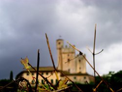
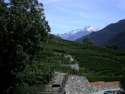
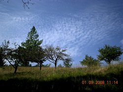
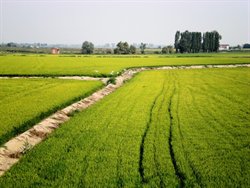
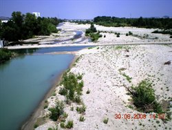
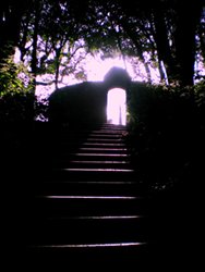
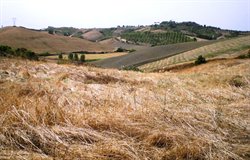
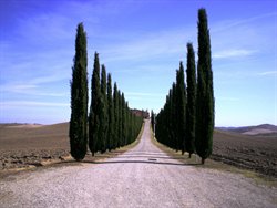
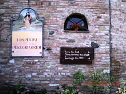
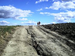
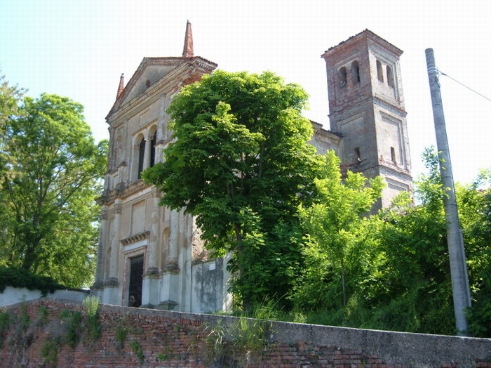
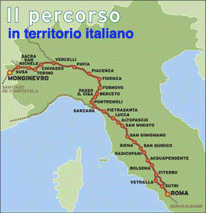
Immagini della Via Francigena in Italia
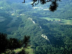
More Via Francigena maps
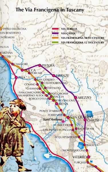
La Via Francigena nella provincia di Parma
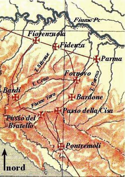
L'tinerario principale parmense è quello che, iniziando appena prima di Fidenza, giunge da Chiaravalle della Colomba e lasciando la Via Emilia giunge a Fornovo: da qui prende il nome di Via di Monte Bardone che, inoltrandosi negli Appennini, giunge al Passo della Cisa. Il percorso stradale, segnalato con appositi cartelli turistici, è anche un percorso trekking.
Da Fidenza a Fornovo
La porta della Via Francigena è costituita dalla cittadina di Fidenza, l'antica "Fidentia Julia" chiamata, in epoca medievale, Borgo San Donnino. Sostare a Fidenza impone la visita del Duomo considerato uno dei massimi esempi dell'architettura romanica padana, la cui facciata (fine XII sec.) fu realizzata su disegno dell'Antelami. Una statua regge un cartiglio che recita "L'apostolo Simone indica che questa è la Via per Roma". A 6 km da Fidenza il moderno pellegrino può visitare il Parco Regionale Fluviale dello Stirone, singolare esempio di museo dei fossili all'aperto.
Le successive tappe ci conducono a Coduro, S. Margherita e Borghetto dove numerose sono le testimonianze del passaggio degli antichi pellegrini: il tratto iniziale era così importante che tutta la zona era denominata "la Francesca". Borghetto era inoltre un'importante tappa, non solo dei romei che andavano a Roma, ma anche dei pellegrini che si recavano a Santiago di Compostela: da alcuni atti risulta che la via principale era detta "il Camino".
Da qui si arriva a Fornovo, la "Philemangenur" di Sigerico, importantissimo nodo posto, ancor'oggi, tra gli Appennini e la Pianura.
Da Parma al Passo della Cisa
Da S. Pancrazio il cammino dei romei volgeva verso Vicofertile la cui Chiesa di S. Geminiano custodisce una notevole vasca battesimale scolpita con figure (fine XII/ XIII sec.). La Pieve romanica di S.Prospero a Collecchio testimonia l'importanza della località sulla Via Francigena. Molti sono i rifacimenti che nascondono l'originaria struttura ma degna di nota è la lastra scolpita in marmo bianco rappresentante il Battesimo di Cristo nel Giordano (XIII sec.) di probabile provenienza bizantina. Parallela all'asse principale, una via collegava Giarola e Oppiano, luoghi privilegiati per i guadi sul fiume Taro: oggi la Corte di Giarola ospita la sede del Parco Regionale Fluviale del Taro e, poco distante, è possibile visitare il Museo Ettore Guatelli, una tra le più complete raccolte di oggetti di cultura, materiale a documentazione di usi, mestieri e tecniche in disuso o perdute del mondo rurale e artigianale. Da Collecchio il percorso portava a Talignano, alla Pieve romanica di S. Biagio che aveva annesso un ospizio. Di notevole interesse la lunetta del portale, raro esempio italiano di rappresentazione di una "psicostasi" ossia la pesatura delle anime dei defunti.
Giunti a Fornovo i pellegrini potevano sostare presso la Pieve di S. Maria Assunta che possiede un ricco corredo scultoreo con precisi riferimenti al tema del pellegrinaggio e del
viaggio, inteso in senso simbolico come redenzione ed espiazione del peccato.
Si prosegue lungo la valle dello Sporzana, mentre esisteva anche una variante che superava il monte Prinzera sul versante occidentale, dove si trova la "Riserva Naturale Orientata", che tutela specificatamente il complesso montuoso costituito da rocce ofiolitiche. Proseguendo lungo lo Sporzana si arriva alla splendida Pieve romanica di S. Maria Assunta di Bardone, una delle più antiche e vaste pievi matrice della Diocesi parmense risalente al XII sec., che oggi conserva parte delle sculture di Fornovo Taro.
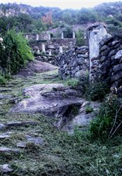
Si raggiungono poi i nuclei di Casola Castello e La Villa, affacciati sulla valle del Baganza proprio contro la costa del Castello di Ravarano, antico fortilizio dei Pallavicino. Di particolare interesse è la zona ambientale detta dei "Salti del diavolo", disposta trasversalmente alla valle, con caratteristici affioramenti rocciosi dall'aspetto di guglie che diventano particolarmente suggestivi. Proseguendo per Berceto si incontra Castellonchio, borgo simile a Cassio come impianto: ovunque la figura del pellegrino, ritratto in pietra o legno, accompagna il cammino.
A Berceto, punto cruciale del percorso organizzato dai longobardi per collegare la Padania con la Tuscia, già nell'VIII sec., re Liutprando costruì una grande abbazia con annessa una chiesa dedicata a S. Abondio, nei pressi del quale si verificò il miracolo delle reliquie di S. Remigio di Reims, di ritorno da un pellegrinaggio a Roma. Dopo l'evento miracoloso (719) il vescovo di Rennes, Moderanno, si stabilì a Berceto dove prese vita una nuova ed intensa devozione.
La Via Francigena prosegue per la Cisa: la chiesa del Passo, attuale santuario della Guardia, innalzato nel 1920, è anche un belvedere di grande interesse paesaggistico. Deviando da Berceto verso la val Manubiola si raggiunge Corchia, esempio notevole di borgo medievale di tipo montano con case di pietra ancora abitate, percorsi lastricati e sottopassi ad arco. Sempre nel parmense, una variante della Via Francigena, detta Via degli Abati, proveniva da Bobbio (Piacenza) per arrivare a Bardi e poi a Borgo Val di Taro.
Da Fidenza a Fornovo
La porta della Via Francigena è costituita dalla cittadina di Fidenza, l'antica "Fidentia Julia" chiamata, in epoca medievale, Borgo San Donnino. Sostare a Fidenza impone la visita del Duomo considerato uno dei massimi esempi dell'architettura romanica padana, la cui facciata (fine XII sec.) fu realizzata su disegno dell'Antelami. Una statua regge un cartiglio che recita "L'apostolo Simone indica che questa è la Via per Roma". A 6 km da Fidenza il moderno pellegrino può visitare il Parco Regionale Fluviale dello Stirone, singolare esempio di museo dei fossili all'aperto.
Le successive tappe ci conducono a Coduro, S. Margherita e Borghetto dove numerose sono le testimonianze del passaggio degli antichi pellegrini: il tratto iniziale era così importante che tutta la zona era denominata "la Francesca". Borghetto era inoltre un'importante tappa, non solo dei romei che andavano a Roma, ma anche dei pellegrini che si recavano a Santiago di Compostela: da alcuni atti risulta che la via principale era detta "il Camino".
Da qui si arriva a Fornovo, la "Philemangenur" di Sigerico, importantissimo nodo posto, ancor'oggi, tra gli Appennini e la Pianura.
Da Parma al Passo della Cisa
Da S. Pancrazio il cammino dei romei volgeva verso Vicofertile la cui Chiesa di S. Geminiano custodisce una notevole vasca battesimale scolpita con figure (fine XII/ XIII sec.). La Pieve romanica di S.Prospero a Collecchio testimonia l'importanza della località sulla Via Francigena. Molti sono i rifacimenti che nascondono l'originaria struttura ma degna di nota è la lastra scolpita in marmo bianco rappresentante il Battesimo di Cristo nel Giordano (XIII sec.) di probabile provenienza bizantina. Parallela all'asse principale, una via collegava Giarola e Oppiano, luoghi privilegiati per i guadi sul fiume Taro: oggi la Corte di Giarola ospita la sede del Parco Regionale Fluviale del Taro e, poco distante, è possibile visitare il Museo Ettore Guatelli, una tra le più complete raccolte di oggetti di cultura, materiale a documentazione di usi, mestieri e tecniche in disuso o perdute del mondo rurale e artigianale. Da Collecchio il percorso portava a Talignano, alla Pieve romanica di S. Biagio che aveva annesso un ospizio. Di notevole interesse la lunetta del portale, raro esempio italiano di rappresentazione di una "psicostasi" ossia la pesatura delle anime dei defunti.
Giunti a Fornovo i pellegrini potevano sostare presso la Pieve di S. Maria Assunta che possiede un ricco corredo scultoreo con precisi riferimenti al tema del pellegrinaggio e del
viaggio, inteso in senso simbolico come redenzione ed espiazione del peccato.
Si prosegue lungo la valle dello Sporzana, mentre esisteva anche una variante che superava il monte Prinzera sul versante occidentale, dove si trova la "Riserva Naturale Orientata", che tutela specificatamente il complesso montuoso costituito da rocce ofiolitiche. Proseguendo lungo lo Sporzana si arriva alla splendida Pieve romanica di S. Maria Assunta di Bardone, una delle più antiche e vaste pievi matrice della Diocesi parmense risalente al XII sec., che oggi conserva parte delle sculture di Fornovo Taro.
Si raggiungono poi i nuclei di Casola Castello e La Villa, affacciati sulla valle del Baganza proprio contro la costa del Castello di Ravarano, antico fortilizio dei Pallavicino. Di particolare interesse è la zona ambientale detta dei "Salti del diavolo", disposta trasversalmente alla valle, con caratteristici affioramenti rocciosi dall'aspetto di guglie che diventano particolarmente suggestivi. Proseguendo per Berceto si incontra Castellonchio, borgo simile a Cassio come impianto: ovunque la figura del pellegrino, ritratto in pietra o legno, accompagna il cammino.
A Berceto, punto cruciale del percorso organizzato dai longobardi per collegare la Padania con la Tuscia, già nell'VIII sec., re Liutprando costruì una grande abbazia con annessa una chiesa dedicata a S. Abondio, nei pressi del quale si verificò il miracolo delle reliquie di S. Remigio di Reims, di ritorno da un pellegrinaggio a Roma. Dopo l'evento miracoloso (719) il vescovo di Rennes, Moderanno, si stabilì a Berceto dove prese vita una nuova ed intensa devozione.
La Via Francigena prosegue per la Cisa: la chiesa del Passo, attuale santuario della Guardia, innalzato nel 1920, è anche un belvedere di grande interesse paesaggistico. Deviando da Berceto verso la val Manubiola si raggiunge Corchia, esempio notevole di borgo medievale di tipo montano con case di pietra ancora abitate, percorsi lastricati e sottopassi ad arco. Sempre nel parmense, una variante della Via Francigena, detta Via degli Abati, proveniva da Bobbio (Piacenza) per arrivare a Bardi e poi a Borgo Val di Taro.
